
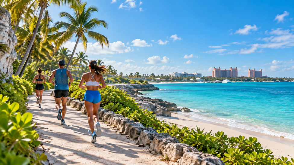
A good trip does not have to mean a week off from training. Nassau and Freeport both have public streets and paths that runners can use at no cost, from a waterfront race course to a bridge with harbor views. This guide covers five routes, each measured on Google Maps in walking mode in October 2026, with distances in miles and kilometers so they are easy to plan around.
1. Goodman’s Bay to Saunders Beach
This is the route for anyone who wants a real race course. The official Run Bahamas 5K starts at Goodman’s Bay, heads east along West Bay Street to a turnaround opposite the Burger King at Saunders Beach Plaza, then returns the same way, according to the Run Bahamas course page.
On Google Maps, the stretch from Goodman’s Bay Park to that turnaround measures 1.6 miles (2.6 km), so the out and back adds up to 3.2 miles (5.2 km). The road curves along the shore past Brown’s Point, and Google describes the route as mostly flat. Running guide Great Runs calls West Bay Street one of the few streets on the island with an adequate sidewalk. Visitors staying on the west side can find more about the area in the Cable Beach guide.
2. Cruise Pier to Paradise Island
Cruise passengers can start right at the ship. From Prince George Wharf, the route follows Bay Street east and climbs the Sir Sidney Poitier Bridge, ending at Marina Village on Paradise Island. Google Maps measures it at 1.7 miles (2.8 km) one way.
The bridge has a walkway for people on foot, and the toll applies only to vehicles. TollGuru lists pedestrians and bicycles at no charge. A runner who did this route from a cruise ship, writing for In The Loop Travel, described the bridge as steep, which makes it a short hill workout, and said the view from the top looks across to Atlantis and back over the harbor. The Nassau cruise port arrival guide explains how the pier connects to downtown.
3. Malcolm’s Park to Harbour Bay
For a calmer session, the waterfront path on the east side of downtown keeps runners off the road. It starts at Malcolm’s Park on East Bay Street, at the foot of the Paradise Island bridge, and runs along the water to Harbour Bay Marina.
Google Maps measures the stretch at 0.9 miles (1.4 km), or 1.7 miles (2.8 km) for the round trip. According to Great Runs, this paved walkway is the safest option in the area because it stays away from traffic. Runners who want more distance can add the bridge climb, since Malcolm’s Park sits at the foot of the bridge. Among the running routes in Nassau, this one is the easiest to fit into a busy morning.
4. Coral Beach to Smith’s Point
On Grand Bahama, Great Runs points to a route of about 4 miles that crosses the Freeport area from west to east using Royal Palm Way, Sea Horse Road and Midshipman Road. Measured on Google Maps from Coral Beach to Smith’s Point Beach along Midshipman Road, it comes to 3.9 miles (6.2 km) one way, with no restricted or private roads flagged.
One detail matters for planning: Great Runs notes there are no sidewalks along most of it, except for a section of Midshipman Road, so an early start with lighter traffic helps.
5. Port Lucaya to Taino Beach
This route starts at the front parking lot of Port Lucaya Marketplace, the same meeting spot used by the Lucayan Run Club. From there it follows Midshipman Road east and drops down to Taino Beach, measuring 2.5 miles (4.1 km) one way on Google Maps.
For company, the Lucayan Run Club meets at Port Lucaya at 6:30 a.m. on the first Saturday and second Sunday of each month, plus some Tuesday and Thursday evenings at 7 p.m. Its page says runs are free to join with no sign up needed, and its motto sums up the mood: “It’s not a race, just find your pace.” Beginners and walkers are welcome. After the run, The Stoned Crab sits right on Taino Beach.
Planning a Run in the Bahamas
Early mornings are the best way to beat the heat, and the Lucayan Run Club’s main runs start at 6:30 a.m. Water, sunscreen and light clothing help on every route. With a race course, a bridge climb, a quiet waterfront path and two coastal routes, running on vacation fits easily into a trip to Nassau or Grand Bahama.
FAQ
Where can I run near the Nassau cruise port?
The route from Prince George Wharf over the bridge to Paradise Island starts at the pier and measures 1.7 miles (2.8 km).
Can you walk or run across the Paradise Island bridge?
Yes. The bridge has a walkway for people on foot, and the toll applies only to vehicles.
Is there a running club in Freeport, Bahamas?
The Lucayan Run Club meets at Port Lucaya at 6:30 a.m. on the first Saturday and second Sunday of each month, free with no sign up.
What is the Run Bahamas 5K route?
It starts at Goodman’s Bay and runs east on West Bay Street to a turnaround near Saunders Beach Plaza.
